News and blogs

Most asset failures don't happen overnight. Corrosion develops gradually, structural stress builds over time, vegetation encroachment poses a creeping risk. Yet asset owners are often working with sporadic snapshots, missing the full picture of how assets and their environments are actively changing.
The problem is compounded by fragmented data: maintenance logs in one system, inspection reports in another, and regulatory documentation are spread across departments. When quick decisions are needed, teams are spending valuable time pulling together often incomplete or outdated information.
Unmanned aerial systems (UAS) play a critical role in closing these gaps by capturing detailed data at greater speed, scale and frequency. But raw data alone isn’t enough. Smarter asset management depends on three things: collecting and combining information efficiently, turning it into insights, and delivering it to decision-makers at the right moment.
UAS technology changes what’s possible. Drones equipped with advanced sensors can cover vast areas in a fraction of the time, delivering consistent, repeatable outputs across remote environments and complex sites.
Routine campaigns make it possible to track change over time, identifying trends and spotting deterioration early and prioritizing interventions accordingly – something traditional inspection schedules often miss.
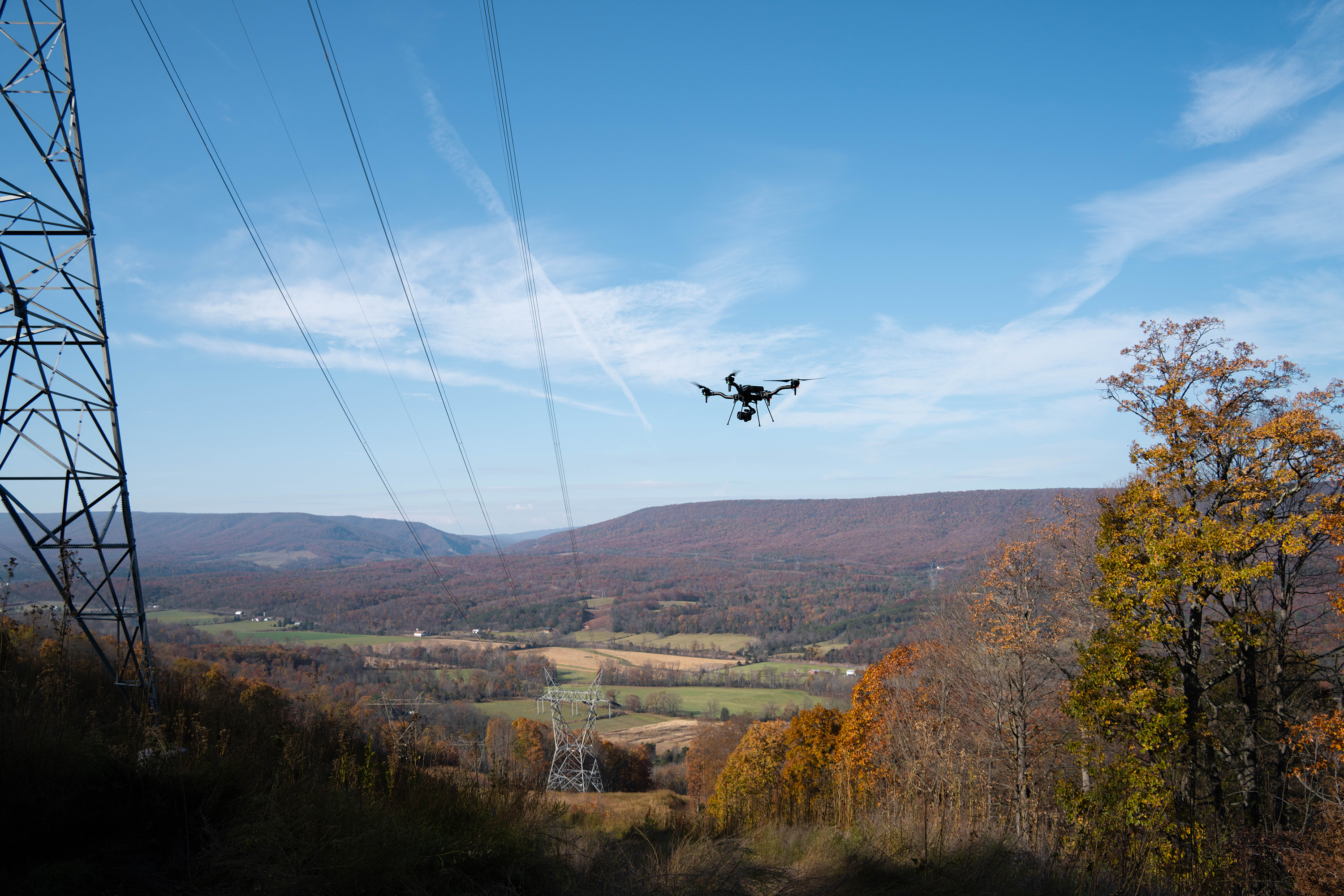
Each flight can generate a range of data types including high-resolution imagery, LiDAR, thermal, radiometric and multispectral data, capturing multiple layers of asset condition in a single operation.
But it’s not just about the drone. Combining UAS data with satellite and survey imagery gives teams macro viewpoints: changes across entire networks, storm impacts, vegetation growth and wildfire risk. Fused with asset records and environmental data, this geospatial intelligence supports predictive analysis at scale.
Data only becomes useful when it’s coherent and connected. That means pulling together information from across the organization into a structured, visual format that supports day-to-day decision-making.
Modern platforms integrate everything: 360° visuals, thermal maps, elevation models, inspection workflows, maintenance history and asset locations. Instead of siloed files, you get unified asset profiles with built-in change tracking.

This enables core workflows. Predictive maintenance draws on historical trends and streams of visual information. Defect detection combines automation with expert review. Compliance reporting is faster and clearer, backed by structured evidence and audit-ready records.
The result is operational clarity and intelligence that’s ready to act on.
Insight-driven decision-making relies on putting data in front of the people who need it. Cloud platforms transform complex datasets into intuitive dashboards and digital twins, giving teams remote access to real-time conditions, wherever they are.
These tools don’t just show data: they embed it into workflows. Maintenance can be triggered by actual condition, not a fixed schedule. Capital planning can prioritize investment based on asset health, not assumptions.
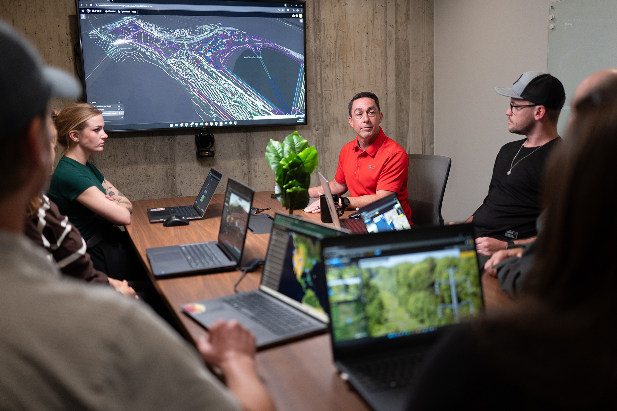
It means faster decisions, better collaboration and deeper context. Within hours of a drone inspection flight, teams can review imagery, compare trends, and coordinate next steps. Instead of reacting to failure, they’re managing performance.
Strategic decisions start with full visibility. That’s why we built iHawk™ as more than just a data viewer. It’s a single pane of glass where teams can access everything, from high-resolution visuals to historical records and real-time alerts, all in one place.
For one power grid customer, this integrated approach underpins their entire digital strategy. iHawk gives asset, operations and project teams access to multi-layered data across thousands of towers and substations. It’s helping to expose integrity risks, identify improvement opportunities, and inform multi-million pound investment decisions.
iHawk also supports planning and coordination across transmission and distribution networks, even helping utilities align on shared developments.
When teams can see the full picture, they move faster, plan smarter and act with confidence.
Drone inspection technology, AI and cloud platforms are redefining asset management: from reactive fixes to predictive planning, and from isolated decisions to co-ordinated strategies across entire asset portfolios.
The organizations that master the data journey from capture to decision will set the new standards for performance, safety and resilience.
Ready to see what’s possible? Learn how iHawk supports smarter asset management.