News and blogs

For operators of complex, distributed infrastructure, the pressure to maintain uptime, control costs and manage risk has never been higher. From power grids, wind turbines, pipelines to offshore platforms, asset owners are expected to anticipate problems before they happen and fix them before they escalate.
Given the stringent demands of modern industrial operations, fixed maintenance schedules and manual inspections are simply too slow, too costly and too reactive to be viable. What’s needed is a smarter, faster way to understand asset conditions in real time: one that supports risk-based decisions and drives better outcomes across the asset lifecycle.
That’s where drones and AI come in. Together, they’re transforming predictive maintenance from a concept into a core strategy.
Unmanned Aerial Systems (UAS) have changed what’s possible in infrastructure inspection. By accessing hazardous, hard-to-reach or structurally complex environments, drones reduce the need for scaffolding, rope access or helicopters. They enable inspection of live assets without shutdowns, improving safety, reducing cost and minimizing disruption.
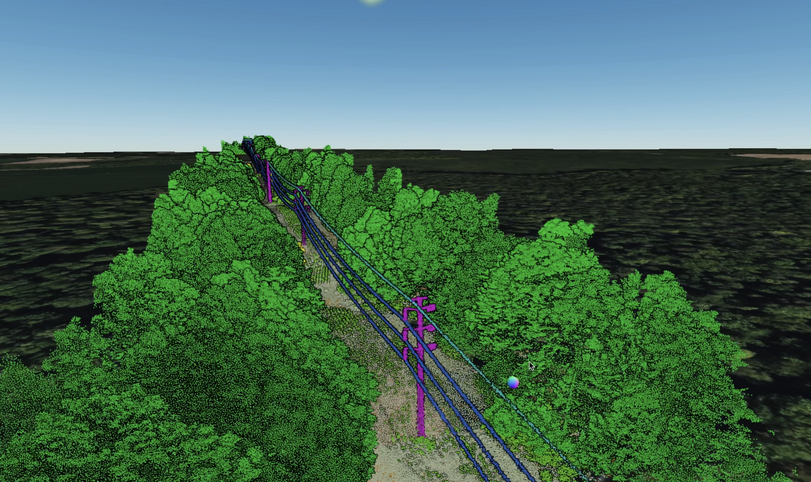
Modern UAS programs are more than just drones and cameras. High-resolution optical sensors, LiDAR, thermal imaging, methane detectors and multispectral payloads allow operators to capture detailed, asset-specific data from every angle. Whether mapping vegetation encroachment near transmission lines, assessing flare stacks for corrosion, or detecting temperature anomalies in substations, drones can gather accurate, repeatable insights across vast networks and challenging terrains.
But while the reach and efficiency of UAS programs are impressive, it’s what happens after the flight that unlocks real value.

Drone inspections generate enormous volumes of data: images, sensor readings, environmental context. Managing and manually reviewing this data is time-consuming and prone to error. Artificial intelligence changes that by enabling faster, more consistent analysis by identifying patterns, detecting anomalies and surfacing what matters most.
Machine learning models can detect signs of deterioration, track change over time and flag issues for prioritization, all with a level of speed and consistency that would be impossible manually. More importantly, when this analysis is integrated into a broader platform, it becomes part of a bigger picture: real-time situational awareness.
Operators gain a clear, up-to-date view of asset condition across sites and systems. This is especially useful in sectors like energy and utilities, where assets may be distributed over hundreds or thousands of miles. AI can prioritize findings, highlight trends and assign risk scores based on severity or likelihood of failure and, combined with geospatial analysis, support rapid triage. It all adds up to faster decisions, enhanced coordination and fewer surprises.

With AI-enhanced drone inspection data, teams can move from routine or reactive maintenance to condition-based strategies – responding to what’s actually happening, and taking action before issues become serious.
By continuously monitoring asset health, operators can anticipate degradation and plan interventions at the right time. This avoids both over-maintaining assets that are still in good condition and underestimating risks that could lead to costly failures.
The result isn’t just less downtime. It’s more predictable maintenance workloads, better allocation of resources, and a stronger connection between inspection data and operational decision-making.
Digital twins add another layer of value. These dynamic, data-driven models mirror the physical state of an asset or system, allowing teams to visualize changes, and explore different maintenance scenarios – all without setting foot on site.
When built using drone inspection and sensor data, digital twins provide a geospatially accurate, view of critical infrastructure. They allow for more collaborative planning, tighter integration with enterprise systems, and stronger alignment between engineering, operations and asset management functions and owners.
For organizations managing long-span, high-risk infrastructure, this kind of visibility is no just longer desirable. It’s becoming essential.
Cyberhawk has been at the forefront of drone inspection services for more than 15 years, with over half a million industrial inspection flights delivered across 40 countries. But our role has evolved.
We’re not just a drone services provider. We’re a provider of asset intelligence, backed by real-world engineering insight, field-proven methodology and scalable digital infrastructure.
Our cloud-based platform, iHawk, is central to that shift. Purpose-built for infrastructure owners, iHawk organizes and analyzes inspection and geospatial data using AI as an enabler for condition tracking, proactive maintenance planning and integration with existing digital ecosystems.
Whether you're planning daily operations or long-term investment strategy, iHawk helps you move from inspection to prediction and from isolated fixes to connected, evidence-based asset inspection strategies.
As drone regulations evolve and technologies like Beyond Visual Line of Sight (BVLOS), autonomous flight and 5G connectivity mature, the future of infrastructure inspection will become even more automated, integrated and intelligent.
But it’s not just about flying further or collecting more data. It’s about what you do with it. The real opportunity lies in turning inspection data into operational intelligence – something that informs action, improves safety and drives performance over time.
In a world of aging infrastructure, tightening margins and rising expectations, drone and AI-driven predictive maintenance isn’t just an efficiency gain – it’s a competitive advantage.
Find out more about how iHawk's AI-enabled analysis turns today's drone inspection flights into tomorrow's maintenance priorities.