Visualizing the entire project lifespan
Using top of the range drones we capture high-resolution imagery and data from your construction sites. This data is then processed into orthomosaic maps, 3D models, point clouds, mesh models, and 360-degree imagery.
Using our proprietary iHawk platform, stakeholders can then view detailed site progress from anywhere in the world, reducing the need for costly and environmentally impactful site visits.
Our services can start at any project stage, from planning and green field surveys, to ongoing construction and establishing drone inspection programs through our advisory service, AVIATE.
Find All
Map and tag-based document search that connects disparate project information sources via Master Tag Register and Doc-to-Tag (D@T) relationships. Only the links (URLs) are held within iHawk; the information itself continues to reside in the source repositories. Get in touch to find out more.
Contact us

Ortho View
Ortho view provides accurate, distortion-free aerial images to ensure reliable and actionable data for all aspects of your site's project management. It provides precise progress assessment and monitoring, along with planning and compliance confirmation.
Find out more

360º Tour
The 360º asset tour module gives access to ground and air tours, either through the inbuilt iHawk spherical functionality or through HoloBuilder. Current and historical tours can be selected based on the data capture date. Get in touch to find out more.
Get in touch

3D View
3D mesh models are rendered and manipulated in the browser to provide a 3D perspective of the site/asset. Volumetric visualizations of capital projects enhance site analysis, facilitate progress tracking, and spatial understandingto enable accurate planning, design, and decision-making throughout the project lifecycle. Get in touch to find out more.
Contact us

Inspection Workflow
Streamlined data collection and analysis across projects will enhance accurate decision-making and improved project management. All visual data can be shared across teams and stakeholders to help maximize your speed to decision. Get in touch with us to find out more.
Learn more
Real Estate Management
Annotate laydown areas, temporary facilities, infrastructure, place construction equipment such as cranes, and give specific time bounds so that an area can be marked for a finite period of time or move around the map as space gets reallocated. Get in touch to find out more.
Contact us

ENSURING SAFETY AND COMPLIANCE
Industrial emissions monitoring and reporting solutions
Cyberhawk offers comprehensive methane, CO2 and other greenhouse gas monitoring solutions to help you trace and measure your fugitive and diffuse emissions over both land and sea. Using the latest probes and drone technology we can check for and monitor emissions in the most challenging environments, enabling you to take mitigating actions to safeguard your team and help ensure you comply with the latest regulations.
Find out more about how we can help Get in touchINDUSTRY-LEADING SOLUTIONS
iHawk in Action
Want to learn more about how iHawk has helped Shell enable full visibility of their Pennsylvania Petrochemical Plant?
Find out more Get in touch
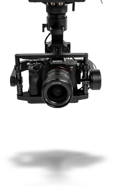
INVESTING IN THE LATEST DRONE TECHNOLOGY
Driving your speed to decision
High quality
State-of-the-art payloads deliver unrivalled detail
Expert pilots
One of the largest pools of qualified pilots in the industry
Security
Data can be delivered securely through our iHawk platform
LEADING THE WAY
Our mission is clear
We will always continue to innovate at the forefront of technology and best practices to deliver value and actionable insights to our customers at scale. This is always to support our mission to capture and deliver the best visual data and information for our customers to help them make better decisions about their assets, and faster.